


Unlocking Better Infrastructure Decisions with GIS

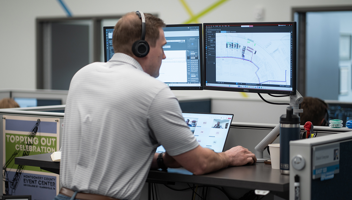
At SSR, delivering actionable infrastructure solutions starts with understanding the full picture, and that’s exactly where Geographic Information Systems (GIS) come in.
GIS is more than mapping. It’s a powerful platform that connects data, people, and places to enable smarter, faster, and more informed decisions across the lifecycle of infrastructure projects. From early planning through design, construction, and long-term operations, SSR’s GIS capabilities help clients visualize complexity, reduce risk, and maximize value.
Turning Data into Actionable Insight
Infrastructure projects generate and rely on enormous amounts of data: utilities, topography, environmental constraints, asset conditions, and more. SSR’s GIS services bring these data layers together into a unified, cohesive spatial environment, transforming raw information into meaningful insights.
By integrating geospatial data with engineering and operational datasets, our teams can:
- Identify constraints and opportunities early in project planning
- Improve site selection and feasibility analysis
- Enhance coordination across disciplines and project teams.
- Reduce costly surprises during construction
The result is better-informed decisions that keep projects on time and on budget.
Supporting the Full Project Lifecycle
SSR’s GIS capabilities extend across every phase of infrastructure delivery:
Planning & Site Evaluation: GIS enables comprehensive analysis of potential project sites, incorporating land use, environmental impacts, and existing infrastructure. This holistic view allows clients to make confident decisions at the earliest stages.
Design & Engineering Integration: During design, GIS aligns spatial data with engineering models, improving accuracy, streamlining workflows, and ensuring all stakeholders are working from the same reliable information.
Construction & Field Enablement: With custom mobile GIS solutions, field teams can capture real-time updates, perform digital inspections, validate site conditions, and maintain accurate records throughout construction.
Asset Management & Operations: Once construction is complete, GIS becomes a long-term asset management tool, supporting ongoing maintenance planning, system visibility, and future expansion.
SSR GIS Services in Action
Utility Mapping
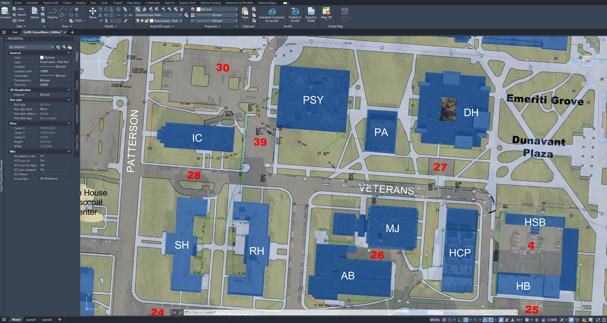
Accurate utility data is foundational to successful infrastructure projects. SSR’s Utility Mapping services provide verified utility information that supports engineering design, asset management, and capital planning.
Our teams collect new utility data and modernize existing CAD models, as-builts, and utility records to create comprehensive GIS mapping systems. Using ArcGIS Field maps and Survey123, supported by custom attribute schemas and optional high-accuracy GPS/GNSS receivers, we develop accurate and maintainable datasets tailored to each client’s needs. The result is reliable, structured data that integrates directly into a client’s existing workflows and systems.
What we deliver:
- Geodatabases containing authoritative GIS datasets for system-wide GIS management
- CAD files and PDFs for engineering workflows and documentation
- Custom interactive dashboards and Experience Builder applications
Asset Inventory & Management
Understanding what assets exist and their condition is critical to long-term system performance and capital planning. SSR provides structured, field-based GIS data collection for infrastructure assets including valves, manholes, hydrants, and pump stations and other components across water, sewer, stormwater, and other utility systems.
Using custom Survey123 forms and Field Maps deployments, our team captures consistent, high-quality data. This information feeds directly into ArcGIS Online hosted feature services, giving owners immediate access and visibility across their system.
Key outcomes include:
- Centralized, accessible asset inventories
- Data structured to support capital planning,prioritization, and budget forecasting
- Integration with CMMS platforms and regulatory reporting requirements
Because infrastructure systems evolve, this service often becomes a repeat engagement, with clients returning for updates, expanded asset inventories, and enhanced dashboards.
Construction & Field Intelligence
SSR’s Construction & Field Intelligence services bring GIS directly into the field, replacing paper-based processes with efficient, digital workflows that capture accurate, real-time data. These tools support inspection documentation, punch list tracking, photo records, and as-built markups in real time.
What sets this apart:
- Timestamped, GPS-tagged records that provide a defensible project history
- Photo and inspection documentation linked directly to spatial features
- Improved coordination between field and office teams
This capability delivers measurable value with minimal incremental cost.
Enhancing Collaboration and Communication
One of GIS’s greatest strengths is its ability to communicate complex information clearly. Interactive maps and dashboards make it easier for stakeholders, technical and non-technical alike, to understand project conditions and progress.
GIS can be used to:
- Improve transparency across project teams
- Facilitate stakeholder and public engagement
- Support data-driven storytelling
Whether coordinating across disciplines or presenting to clients and communities, GIS helps translate data into understanding.
Delivering Value Through Innovation
SSR’s GIS approach is rooted in innovation and practicality. We tailor solutions to meet each client’s unique needs, whether that means building custom spatial databases, developing interactive dashboards, or integrating GIS into broader digital strategies.
By leveraging GIS, SSR helps clients:
- Optimize infrastructure investments
- Mitigate risk through better visibility
- Improve long-term operational efficiency
- Adapt more quickly to changing conditions
A Smarter Way Forward
As infrastructure systems grow more complex, the need for integrated, data-driven solutions continues to increase. GIS is a critical tool in meeting that challenge, and SSR is proud to bring this capability to our clients and partners.
By combining geospatial expertise with deep engineering knowledge, SSR delivers solutions that don’t just meet today’s needs but position clients for long-term success.